
Skilled in software development with Java and Python.


Seasoned with HTML, CSS, and JavaScript. Proficient with libraries like D3 and OpenLayers.


Experience developing responsive applications and serving data in the web, preferring Spring Boot + Jakarta (JavaServer) Faces (JSF) + Primefaces for building all-round interactive SPA's, and REST API's.


I believe Git is the way, experienced in DevOps and CI/CD, leveraging gitlab/github/gitea pipelines. Routinely deploying with docker in linux, and monitoring with prometheus and grafana.


Backend experience developing CRUD applications for Neo4j (graph), Qdrant (vector), Postgres (relational), PostGIS (geospatial).

Well versed in unit (jUnit), integration and system testing (Selenium), while integrating with version control pipelines.
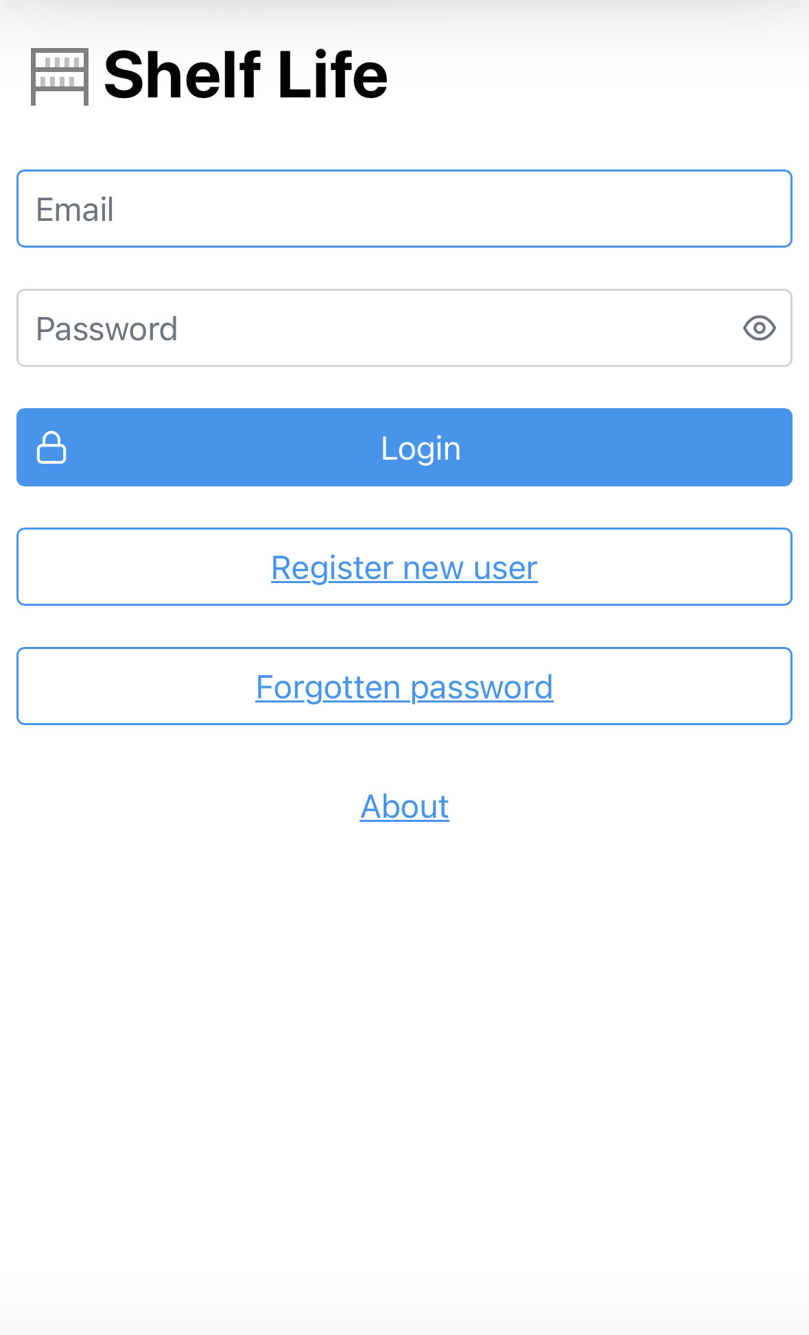
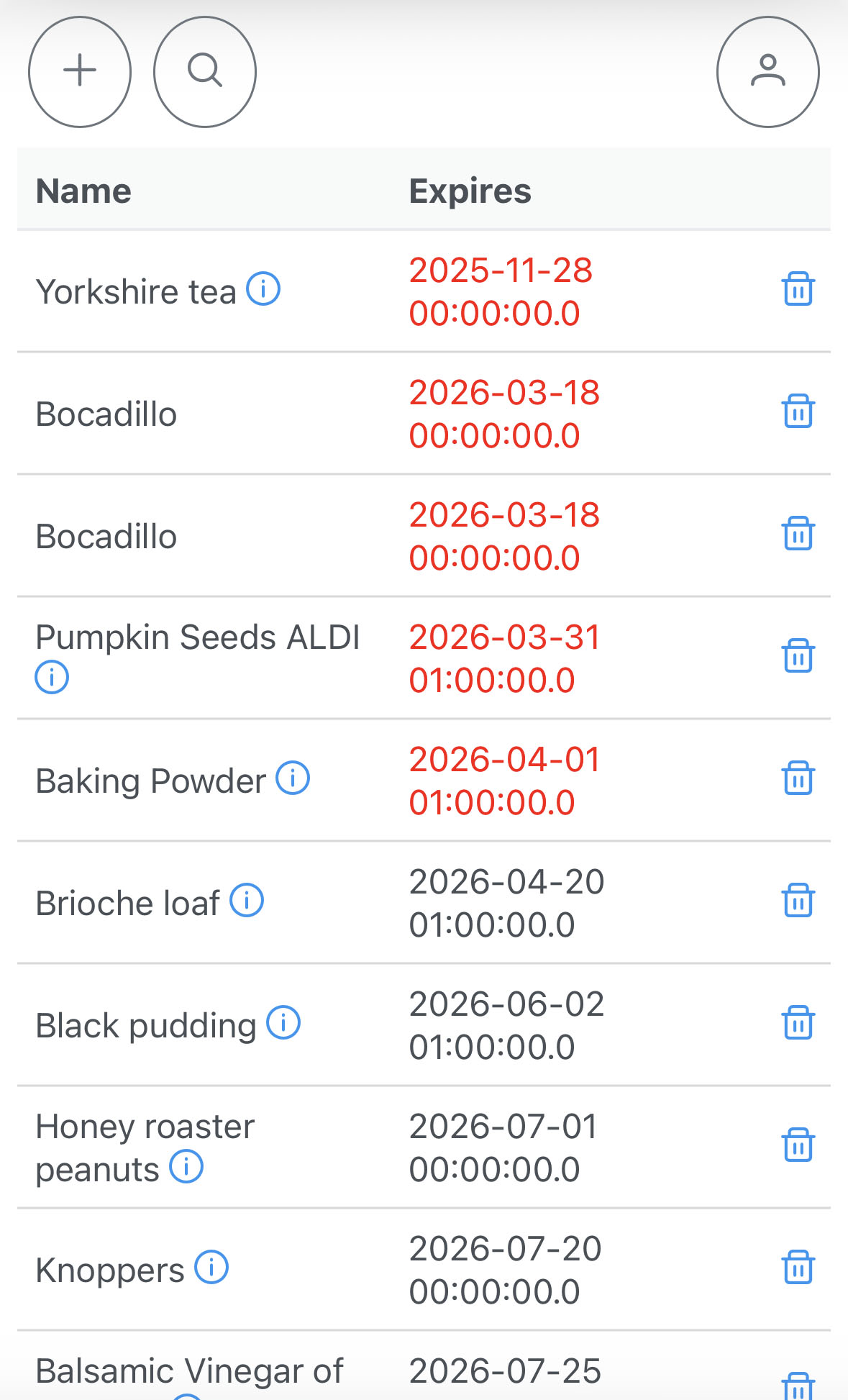
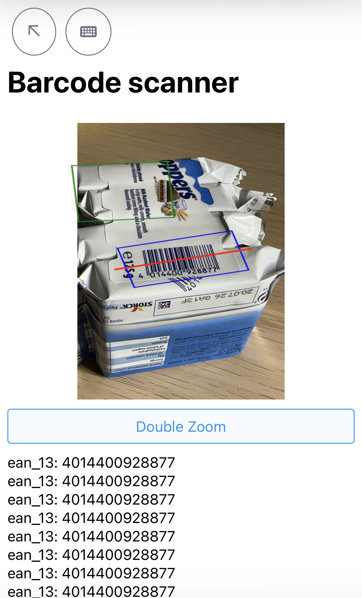
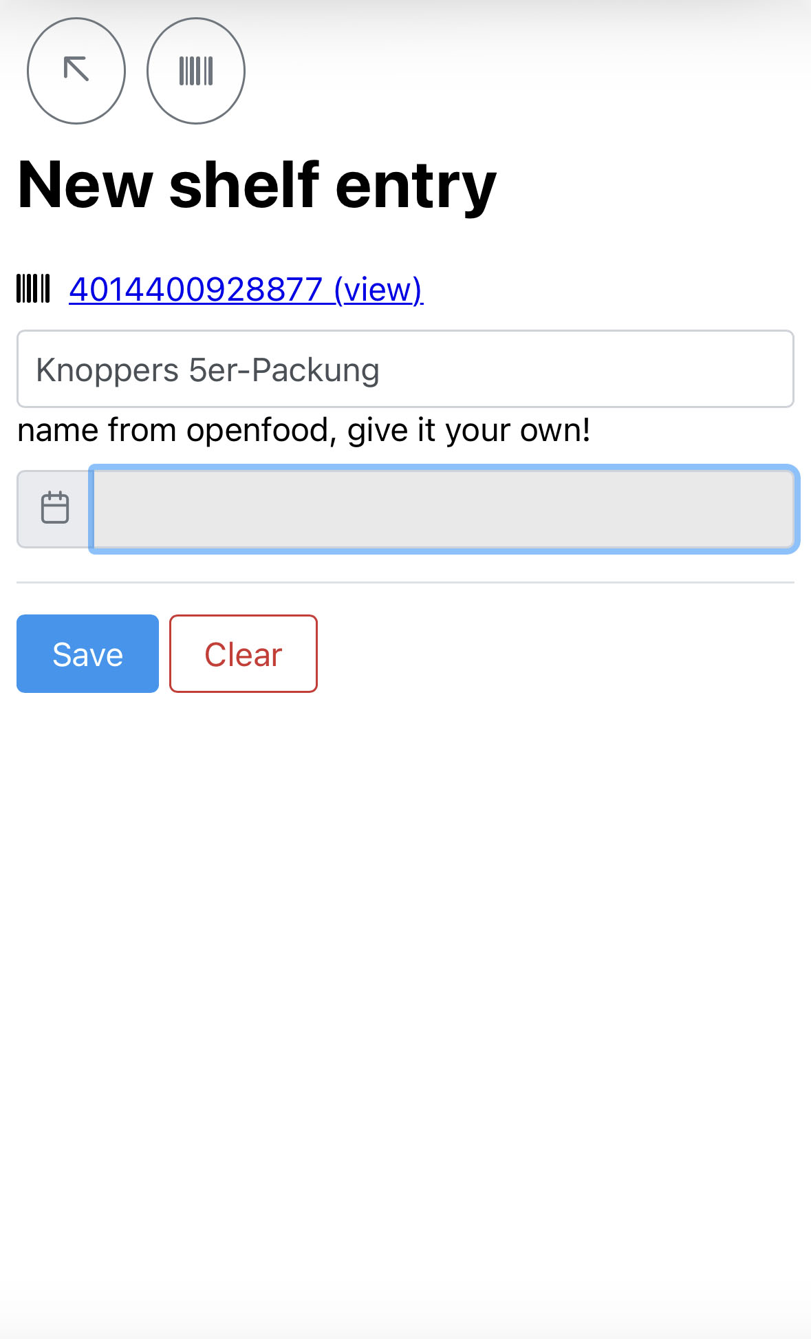
Shelf Life
Needing help to keep track of the kitchen's shelf, trying to avoid waste, developed Shelf Life to keep track and remind me and my friends of shelf item's expiracy dates with email reminders.
Finance tracking tools
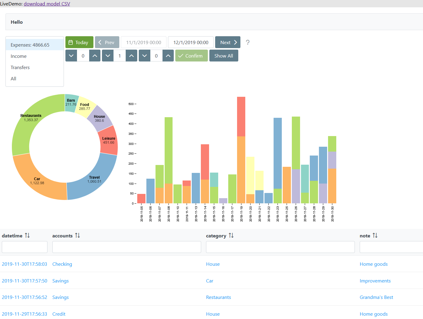
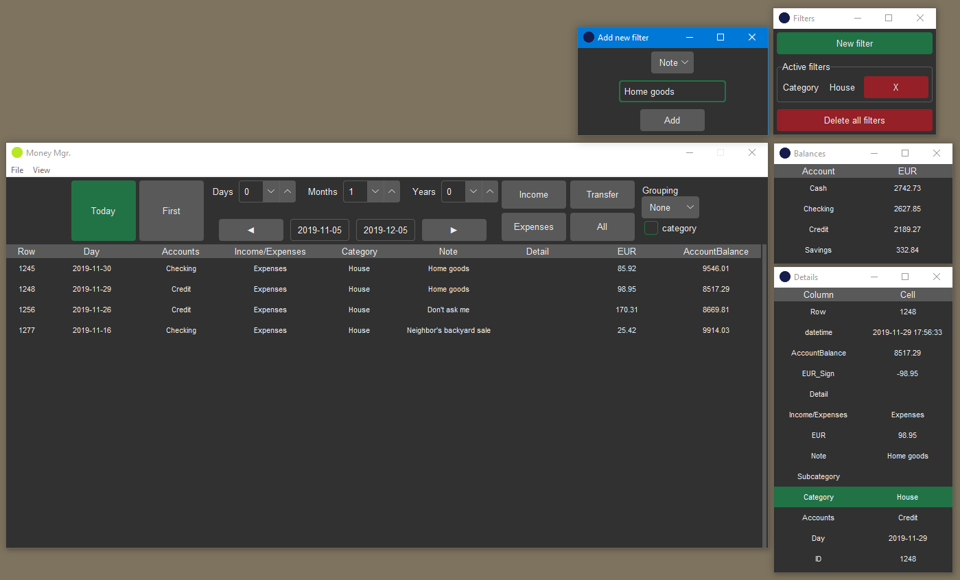
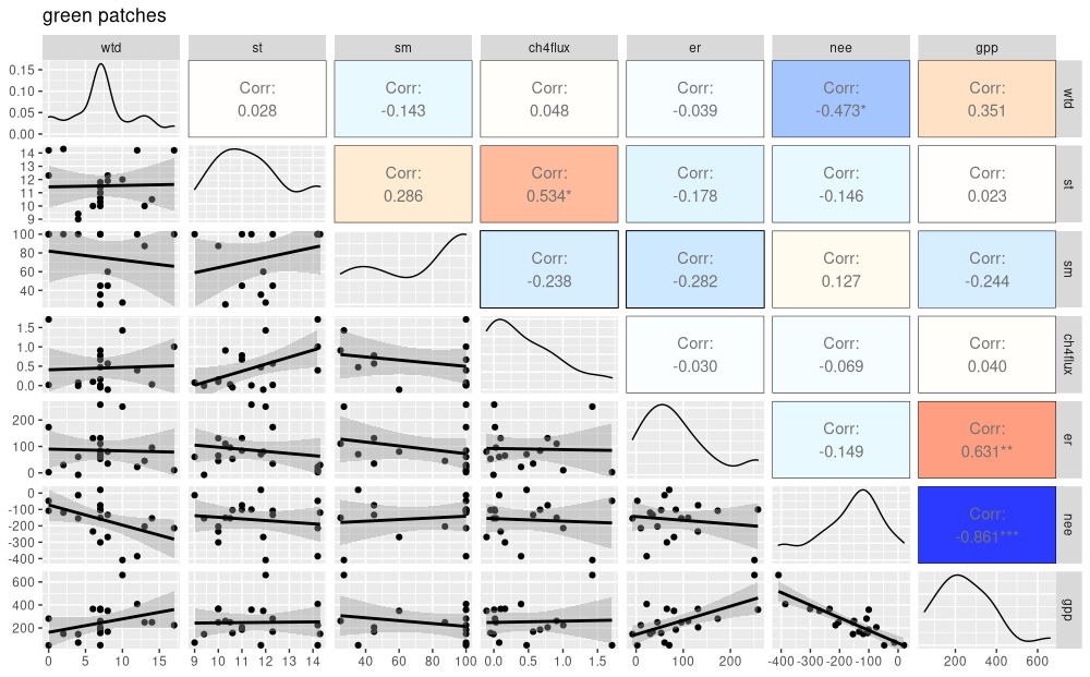
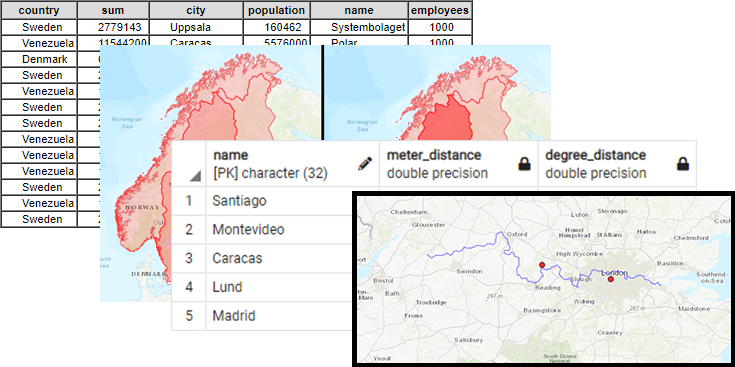
Needing to keep track of my finances, and absolutely tired of third-party apps selling my data, I have worked some personal solutions that have made public in different ways.
Developed a web application to parse a csv file into a nice dashboard combining Spring Boot, JSF, Primefaces and D3. Live demo available in finances.salvadorh.com.
Had a previous solution built with Python: tk-inter, pandas, and matplotlib. Where a csv is provided via CLI, but it felt outdated, slow and clunky. Nonetheless the Source Code is freely available.
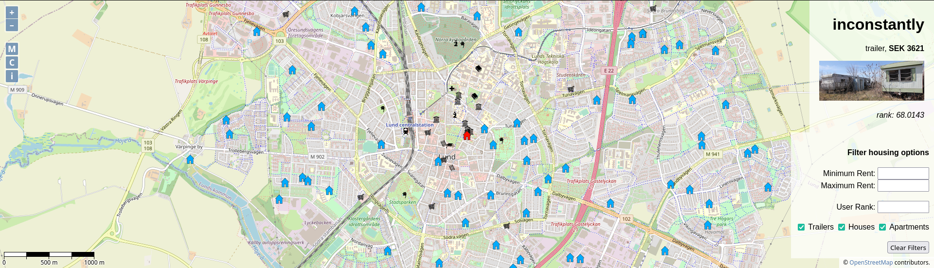
Housing Project
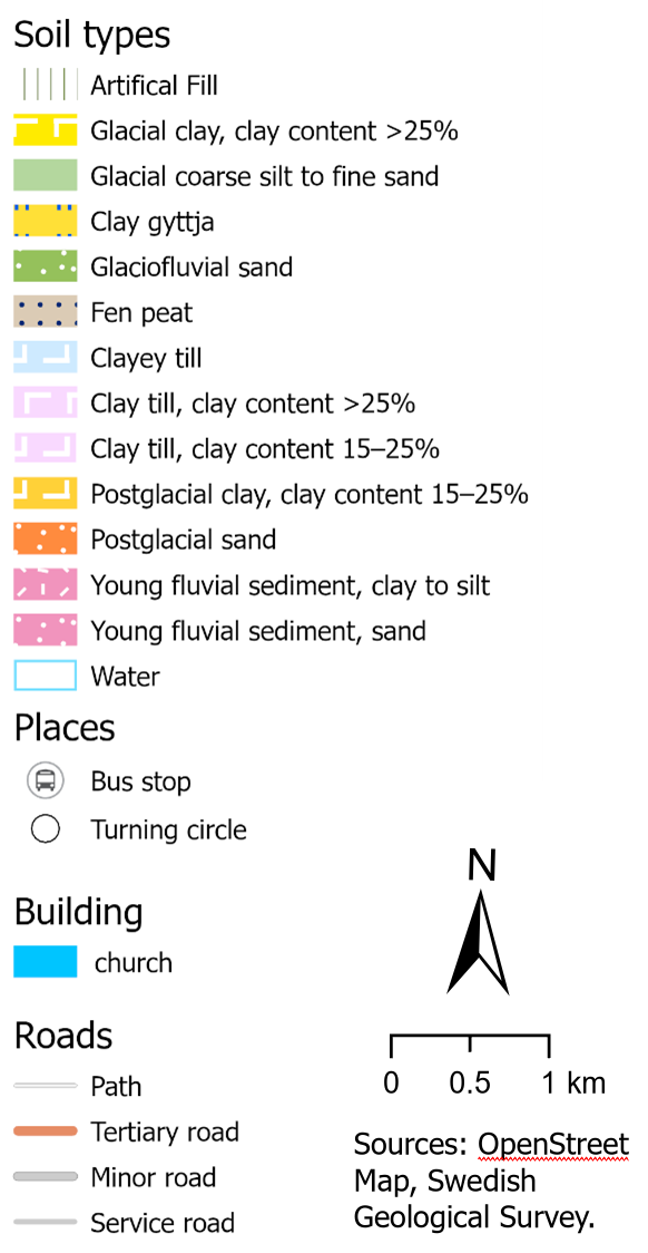
Developed a web map gui for a project during my Master's Programme, aimed for any of the Housing Agencies in Lund (Sweden), since most missed geospatial browsing at the time.
Using OpenLayers, OpenStreet Map (OSM), and WMS requests to a GeoServer. All data is dummy data.
CIAL School's website
In 2014 wrote a school's website from scratch, and maintained it until 2019.


Inclined towards open-source tools. Experienced with QGIS, Google Earth Engine (GEE), ArcGIS, ArcPro, PostGIS (PostgreSQL), GDAL.
Experienced streamlining repetitive tasks programatically. Data ingestion, visualization, ETL.
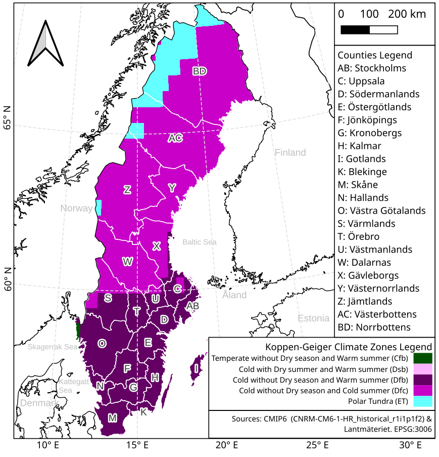
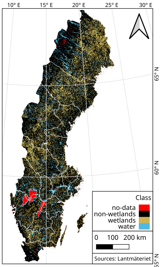
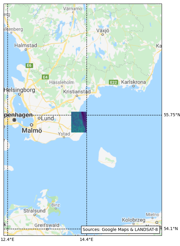
Master's Thesis: “Monitoring wetlands in Sweden using multi-source satellite data and machine learning algorithms”
Developed a pipeline workflow for classifying wetlands all over Sweden, using Google Earth Engine (GEE), in Javascript.
Gathering multi-source multi-temporal imagery, from Sentinel-1 and Sentinel-2 satellites, and combining it with topographical data.
Applying a Machine Learning Random Forests classifier. Available at Github.
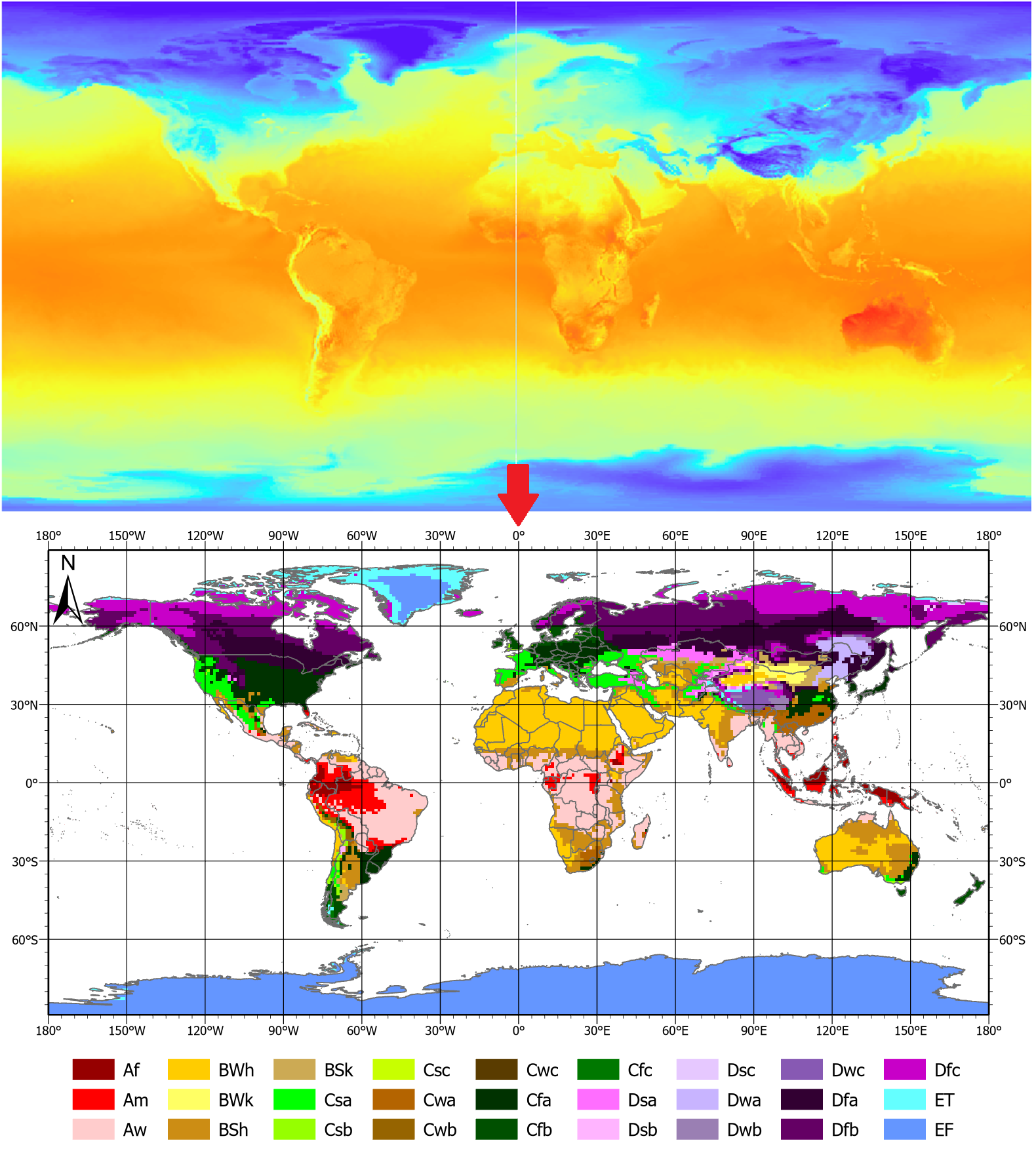
Project: The prospects of coffee cultivation in South America in a future climate
Developed a group of Python scripts for classifying The Earth's climate zones based on Köppen-Gauger method, averaging climate normals, for global NC files with temperature and precipitation data from two CMIP6 experiments: Historical (1850-2015) and Representative Concentration Pathway (RCP) 8.5 (2015-2100) models. Available at Github.
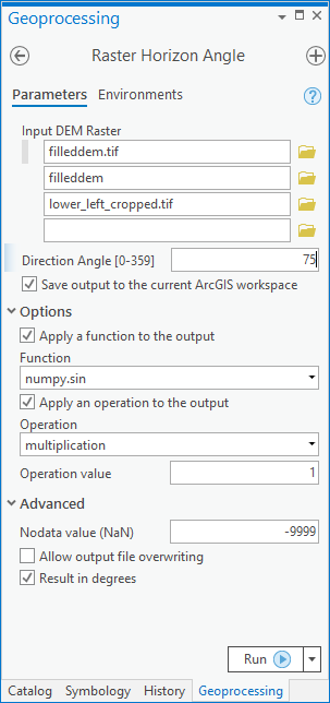
Project: Horizon Angles (ArcGIS Toolbox)
Developed a script that calculates the maximum angular obstruction for each cell on a raster, particularly from a digital elevation model (DEM), recreating functions from GRASS GIS and GDAL, it combines ArcPy. The project required the design of a graphic user interface (GUI) allowing to easily parse parameters between ArcGIS and Python. Available at Github.
GIS experience including: Data Management, Harmonization, Digitization, georeferencing, Remote Sensing, Satellite Imagery, Spatial Databases (SQL & PostGIS), Cartography, Geostatistics
(click images above to increase size)
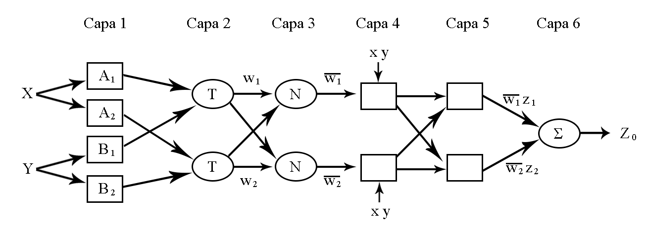
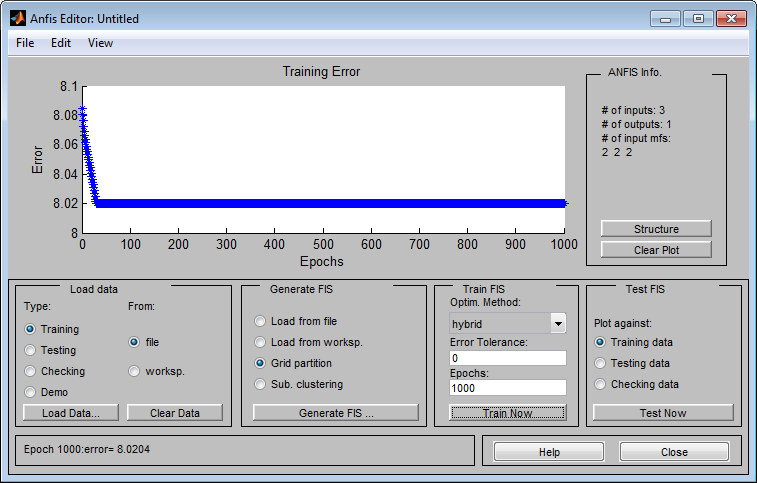
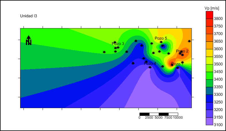
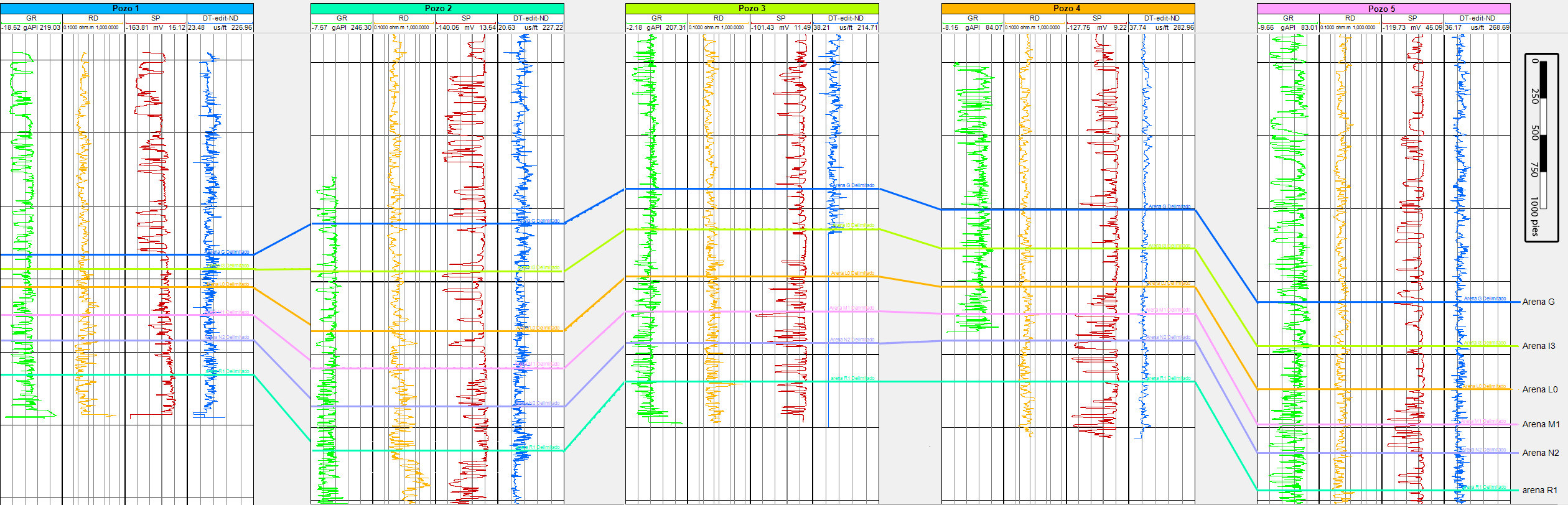
Bachelor's Thesis: “Vp logs prediction from well logs and seismic using ANFIS”

The goal was to infer sonic logs for 27 wells located in a productive basin in Venezuela, using fuzzy logic and neural networks combining radioactive and resistive logs, with different seismic attributes resampled and extracted from a seismic cube, as input for the neuro-fuzzy (machine learning) regressor. The generated maps showed the expected low p-wave velocity behavior for most of the geologic horizons around each currently active well. And the accuracies
For the project we employed OpendTect Neural Networks module, MATLAB ANFIS (Adaptative Neuro-Fuzzy Inference System) for training the fuzzy sets, SegyMat library for reading traces and Oasis Montaj for data management.
Arch User Repository (AUR) Maintainer
Maintained a couple of packages for the Arch Linux community: pktools && Windscribe-cli
Web-scrapped with BeautifulSoup to automatically check with a python script for new updates every so often.
Woman in Data Science (WiDS) Datathon 2022
Team'ed-up with three friends to participate in a Kaggle competition. And even though we were not close to win, it resulted a very enriching experience. Github Gist.
Google Keep Takeout
A simple script for simplifying Google keep notes takeout from JSON to TXT